


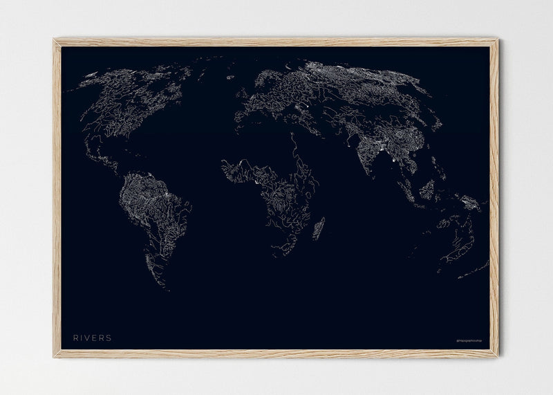


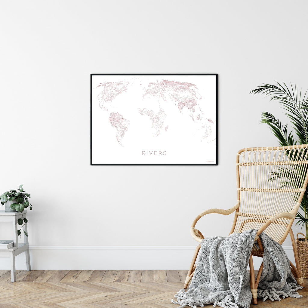
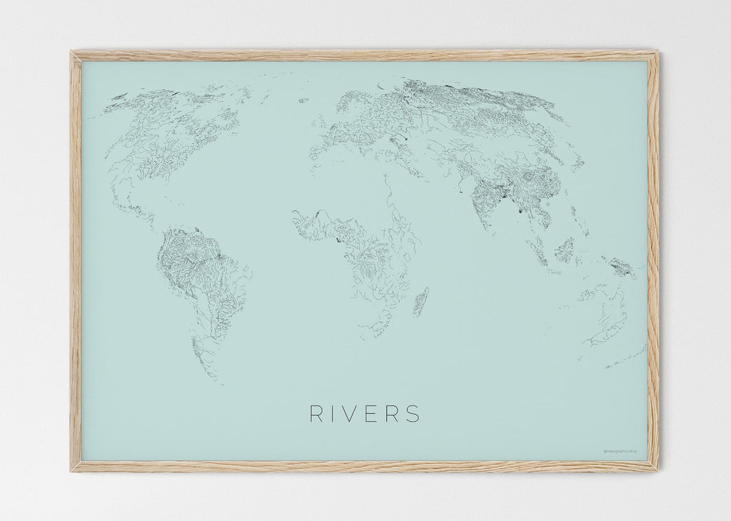


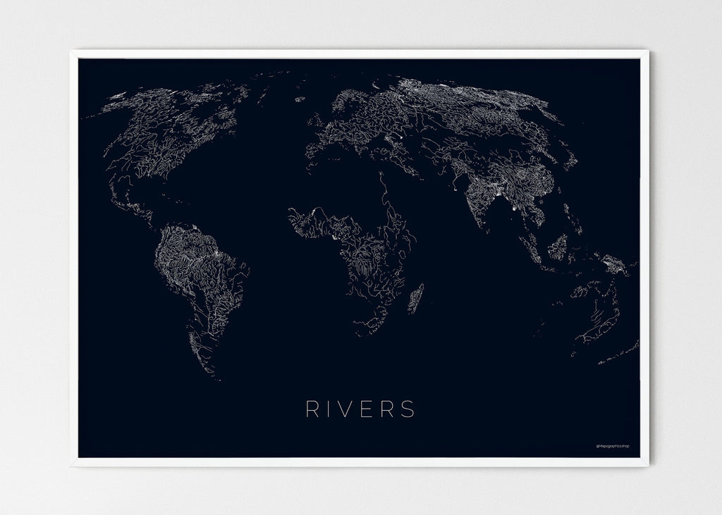


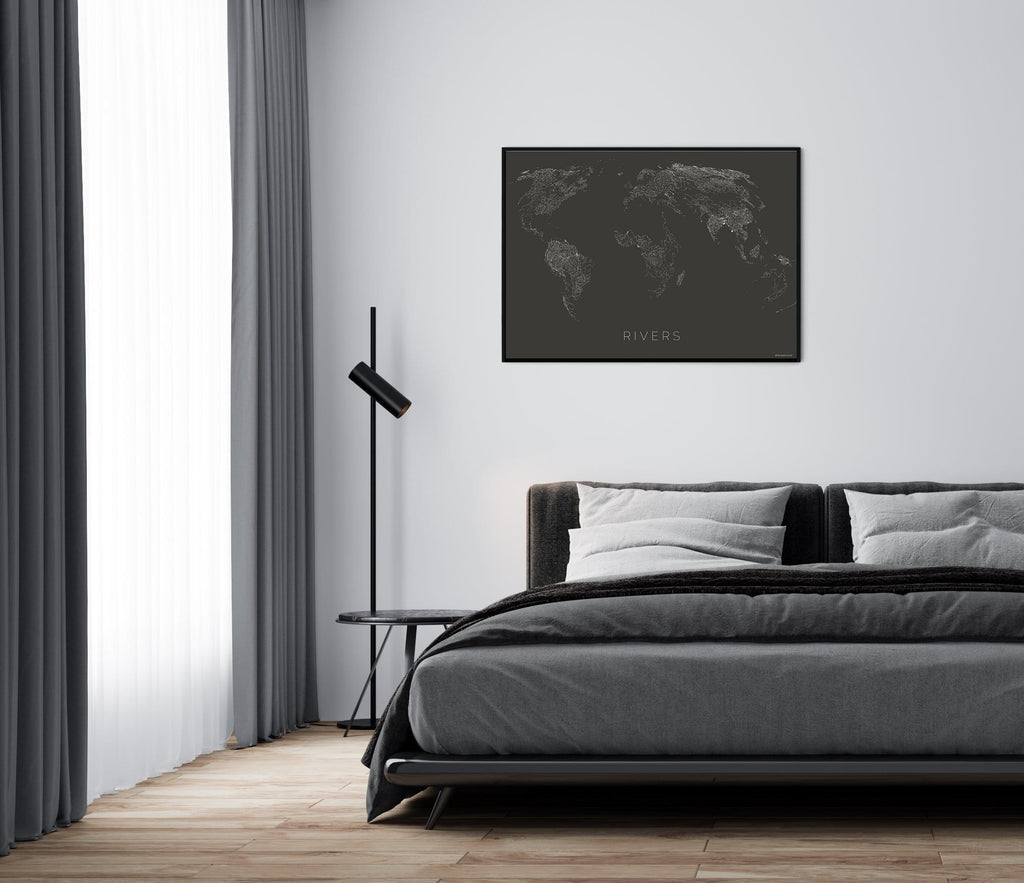
THE WORLD AS RIVERS
THE WORLD AS RIVERS
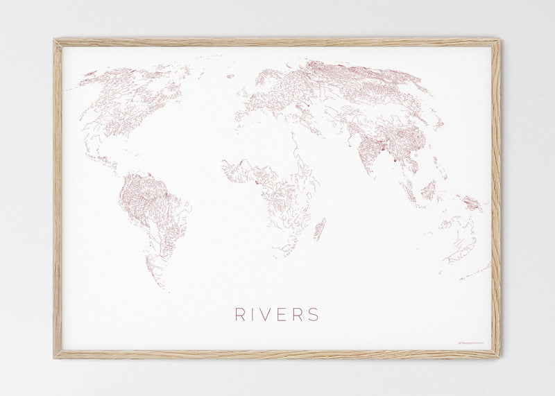
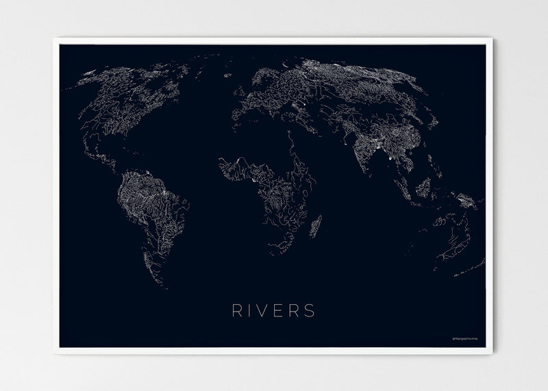
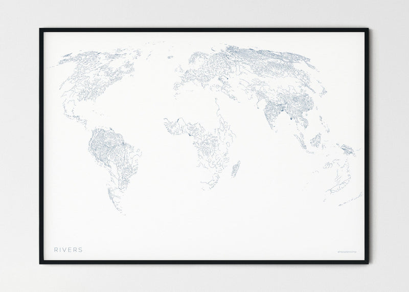
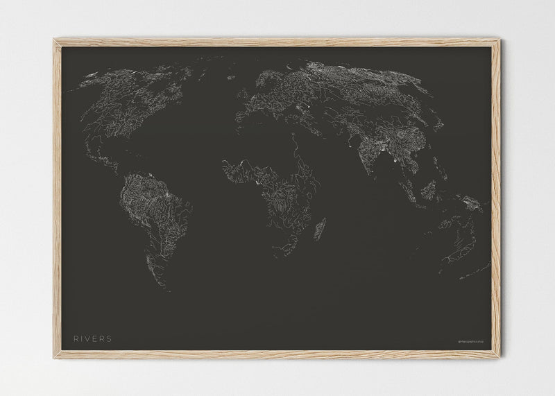
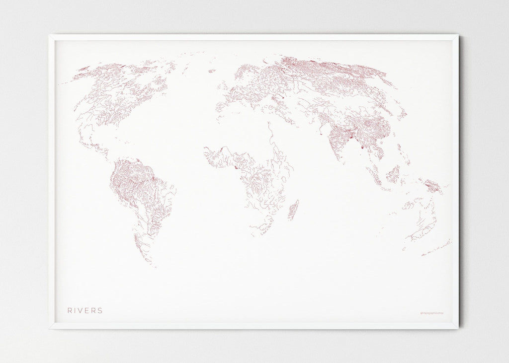
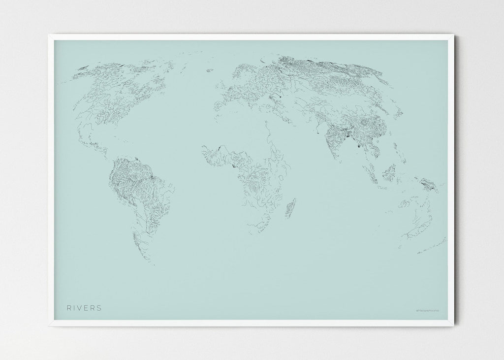
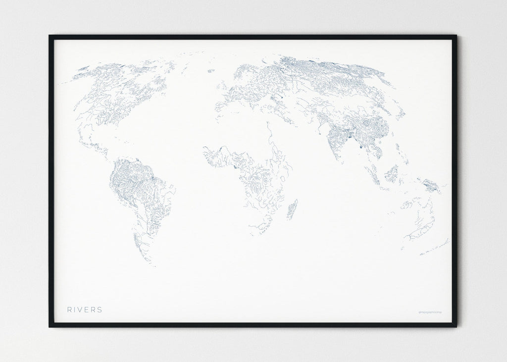
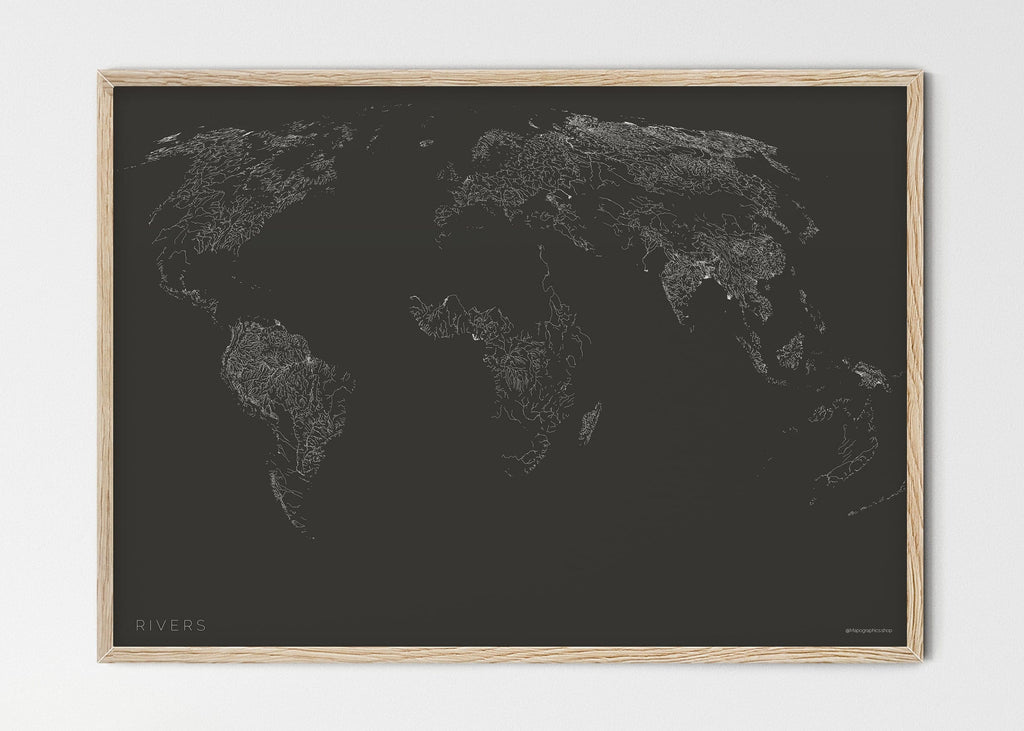
Rivers were the birthplace of human civilization. The Tigris, the Euphrates and the Nile enabled humans to transition from nomadic life to settled farming.
Satellite data from Landsat was used to create 468.000 km2 of observable rivers. The lines represent the location of the rivers; size is not represented (all rivers are shown with the same width).
Rivers can also provoke conflicts. With more than 200 rivers running across country borders, people dispute about river usage in the areas where water is a scarce resource.
About this print
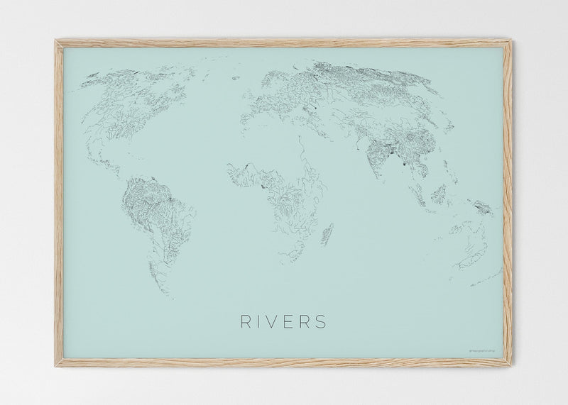
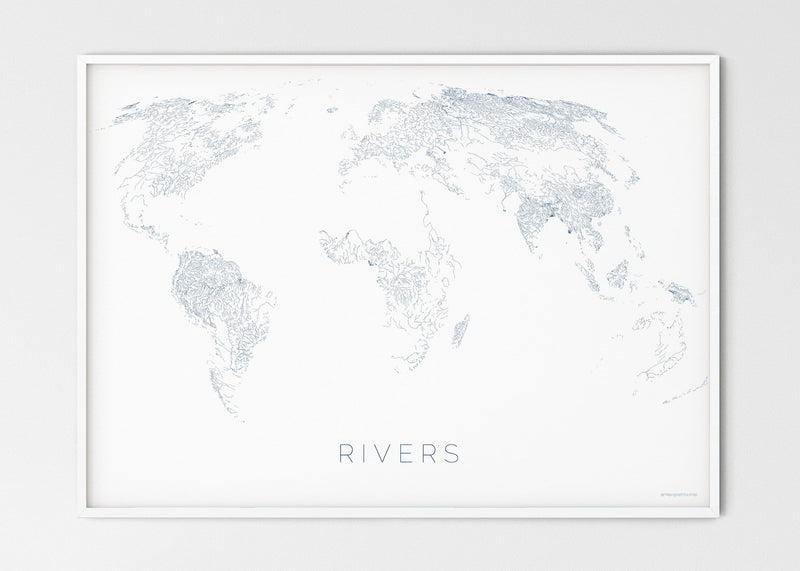
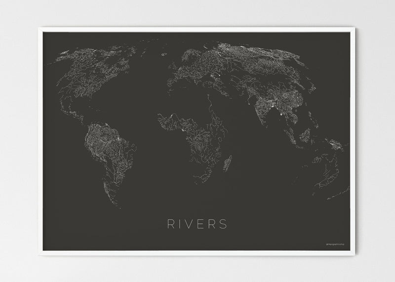
A serene, minimalist fine art print celebrating the world's waterways.
Printed on demand on premium semi-glossy paper for crisp detail and rich color – a high-quality poster and a lasting piece of wall art. Available in 70x50 cm and 100x70 cm.
Style it with our wooden frames or magnetic poster hangers for a gallery-ready look in your living room, office or study.
Print quality
The map is printed using museum-quality paper weighting 200g/m2 (200 gsm / 80 lb), using thick and long-lasting premium matte paper. The paper is FSC certified, which means that it is derived from a sustainably managed forest, and we use environmentally friendly ink. Prints are to a large extent locally printed, which saves transport emissions.
Please note that the print does not come with a frame or a hanger, this needs to be ordered separately.
Frames
A beautiful wooden frames with the following specifications:
- Lightweight 1-2 cm (0.4-0.8") thick frame
- Shatterproof, transparent plexiglass.
- Includes hanging kit, to hang in both portrait and landscape orientations.
- For indoor use
Please note that the print are sold separately from the frame.
Hangers
A wooden magnetic poster hanger. Each hanger includes four wooden sticks, two that clamp the top of your print and two that clamp the bottom and a premium leather cord that matches the hanger colour. Strong magnets securely grip your artwork, while easily you to change the art whenever is needed.
- Magnetic design holds your print without damaging it.
- Premium leather cord matches the hanger colour.
IMPORTANT NOTE: For prints that are 100x70 cm, then hanger which is 71 cm only fit to the Arctic Bathymetry map, since this is the only map with a vertical orientation.
Please note that the prints are sold separately from the hanger.
Free shipping
We offer free worldwide shipping. It will usually take 5-7 days for you to receive your products from us. After ordering, you will receive an order confirmation. Once the poster is printed and shipped a notification of the track id of your shipment will be emailed to you.
The map is shipped in sturdy packaging protecting the poster
We have used the following data sources for making these maps:
Airports regions
Data source: https://openflights.org/data.html. The database has been compiled from data stored on OurAirports.com and the Digital Aeronautical Flight Information File (DAFIF), curated by the National Geospatial-Intelligence Agency (NGA).
Airports
Data source: https://openflights.org/data.html. The database has been compiled from data stored on OurAirports.com and the Digital Aeronautical Flight Information File (DAFIF), curated by the National Geospatial-Intelligence Agency (NGA).
Boarders
Data source: Flanders Marine Institute. www.marineregions.org
Flight routes
Data source: Huang Z, Wu X, Garcia AJ, Fik TJ, Tatem AJ (2013) An Open-Access Modeled Passenger Flow Matrix for the Global Air Network in 2010. PLoS ONE 8(5):e64317. doi:10.1371/journal.pone.0064317
Night lights
Data source: National Oceanic and Atmospheric Administration. National Centers for Environmental Information. https://ngdc.noaa.gov/eog/dmsp/downloadV4composites.html
Power lines
Data source: Open Street Map. https://wiki.openstreetmap.org/wiki/Tag:power%3Dline
Power plants
Data source: Data source: Global Energy Observatory, Google, KTH Royal Institute of Technology in Stockholm, Enipedia, World Resources Institute. 2018. Global Power Plant Database. Published on Resource Watch and Google Earth Engine; http://resourcewatch.org/ https://earthengine.google.com/
Railways
Data source: Open street maps. https://wiki.openstreetmap.org/wiki/Key:railway
Endagered species
Data source: Mapographics, IUCN.
Rivers
Data source: Allen and Pavelsky (2018) Global Extent of Rivers and Streams. Science.https://doi.org/10.1126/science.aat0636
Roads
Data source: Meijer, J.R., Huijbegts, M.A.J., Schotten, C.G.J. and Schipper, A.M. (2018): Global patterns of current and future road infrastructure. Environmental Research Letters, 13-064006. Data is available at www.globio.info
Shipping
Data source: Benjamin Halpern, Melanie Frazier, John Potapenko, Kenneth Casey, Kellee Koenig, et al. 2015. Cumulative human impacts: raw stressor data (2008 and 2013). Knowledge Network for Biocomplexity. doi:10.5063/F1S180FS.
Human biomes
Data source: Ellis, E. C., K. Klein Goldewijk, S. Siebert, D. Lightman, and N. Ramankutty. 2010. Anthropogenic transformation of the biomes, 1700 to 2000. Global Ecology and Biogeography 19(5):589-606
Arctic bathymetry
Data source: Mapographics, Becker, J. J., D. T. Sandwell, W. H. F. Smith, J. Braud, B. Binder, J. Depner, D. Fabre, J. Factor, S. Ingalls, S-H. Kim, R. Ladner, K. Marks, S. Nelson, A. Pharaoh, R. Trimmer, J. Von Rosenberg, G. Wallace, P. Weatherall., Global Bathymetry and Elevation Data at 30 Arc Seconds Resolution: SRTM30_PLUS, Marine Geodesy, 32:4, 355-371, 2009. Sandwell, D. T., and W. H. F. Smith, Global marine gravity from retracked Geosat and ERS-1 altimetry: Ridge Segmentation versus spreading rate, J. Geophys. Res., 114, B01411, doi:10.1029/2008JB006008, 2009."
Intact nature
Data source: Tim Newbold; Lawrence N Hudson; Andrew P Arnell; Sara Contu et al. (2016). Dataset: Global map of the Biodiversity Intactness Index, from Newbold et al. (2016) Science. Natural History Museum Data Portal (data.nhm.ac.uk). https://doi.org/10.5519/0009936
Contours
Data source: Nasa. Jet Propoulsion Laboratory. ASTER Global Digital Elevation Map.
Forest cover
Data source: Hansen, M. C., P. V. Potapov, R. Moore, M. Hancher, S. A. Turubanova, A. Tyukavina, D. Thau, S. V. Stehman, S. J. Goetz, T. R. Loveland, A. Kommareddy, A. Egorov, L. Chini, C. O. Justice, and J. R. G. Townshend. 2013. “High-Resolution Global Maps of 21st-Century Forest Cover Change.” Science 342 (15 November): 850–53.
Land cover
Data source: Chen J., Ban Y., Li S. China: Open access to Earth land-cover map[J]. Nature, 2014, 514(7523): 434-434. DOI:10.1038/514434c.
Human density
Data source: WorldPop (www.worldpop.org - School of Geography and Environmental Science, University of Southampton; Department of Geography and Geosciences, University of Louisville; Departement de Geographie, Universite de Namur) and Center for International Earth Science Information Network (CIESIN), Columbia University (2018). Global High Resolution Population Denominators Project - Funded by The Bill and Melinda Gates Foundation (OPP1134076). https://dx.doi.org/10.5258/SOTON/WP00647
Human footprint
Data source: "Venter, O., E.W. Sanderson, A. Magrach, J.R. Allan, J. Beher, K.R. Jones, H.P. Possingham, W.F. Laurance, P. Wood, B.M. Fekete, M.A. Levy, J.E. Watson. 2016. ""Global Terrestrial Human Footprint Maps for 1993 and 2009."" Scientific Data 3: 160067. http://dx.doi.org/10.1038/sdata.2016.67. Accessed through Resource Watch, (date). www.resourcewatch.org."
Buy it with